
There's a longer story behind Source2Sea, and if you haven't read it yet, you can find it on the My Story page. The short version: my wife, Nikki, was diagnosed with multiple sclerosis (MS) in 2023, and this mission is my way of doing something about it. Five rivers. Five years. One mission. Hiking, cycling and kayaking each river from source to sea, raising funds for the MS Society and awareness for the 150,000 people living with the condition in the UK. Adventure with Purpose.

The River Severn is the longest river in the UK, stretching roughly 354km from its source high in the Cambrian Mountains to its mouth at the Bristol Channel. It passes through some of Britain's most historically significant landscapes (medieval market towns, the birthplace of the Industrial Revolution, a cathedral city or two) before widening into the vast tidal estuary that eventually becomes the sea. Zoom out on a map and the river's course traces something close to a question mark. As it turned out, that was rather fitting. Rarely has a river's shape so accurately predicted what was to come.
Most people who know the Severn know its southern stretches. Growing up in rural Gloucestershire and now living in Worcester, I certainly did. But tracing it from source to sea, on foot, on a bike, and on the water, gave me a completely different relationship with a river I thought I already knew. That's what this article is about. Specifically, how Expedition One actually unfolded across eight consecutive days, starting on 20th September 2025.
The original plan was two days hiking, half a day cycling, four and a half days kayaking, and a final day on the bike. Eight days, three disciplines, one river. Flooding changed everything. Here's how it actually played out.
| Day | Date | Route | Distance |
|---|---|---|---|
| 1 Hike | Sat 20 Sep | Hafren Forest to Llanidloes | 30km |
| 2 Hike | Sun 21 Sep | Llanidloes to west of Newtown | 31km |
| 3 Cycle | Mon 22 Sep | Newtown to Shrewsbury | 66km |
| 4 Cycle | Tue 23 Sep | Shrewsbury to Ironbridge | 40km |
| 5 Cycle | Wed 24 Sep | Ironbridge to Bewdley | 49km |
| 6 Kayak | Thu 25 Sep | Bewdley to Clevelode, Clevelode | 35km |
| 7 Kayak | Fri 26 Sep | Clevelode to Gloucester Rowing Club | 41km |
| 8 Cycle | Sat 27 Sep | Gloucester to Battery Point, Portishead | 81km |
| Total | 373km | ||
NOTE: Distances are taken from actual Strava activity data and are slightly longer than the planned route (342km) due to factors such as wandering off-route on breaks, forgetting to pause tracking, or the occasional small detour.
Biblical Rain and a Lifeline in Llanidloes
My friend Alex joined me for the two-day hike. Alex has his own deep connection to MS. His dad lives with the condition, and earlier in 2025 he completed a Land's End to John O'Groats hike for the MS Society, raising over £10,000. I joined him for two days through Shropshire, so having him return the favour felt right. As it turned out, it was more than right. It was necessary.
What didn't feel right was the weather.
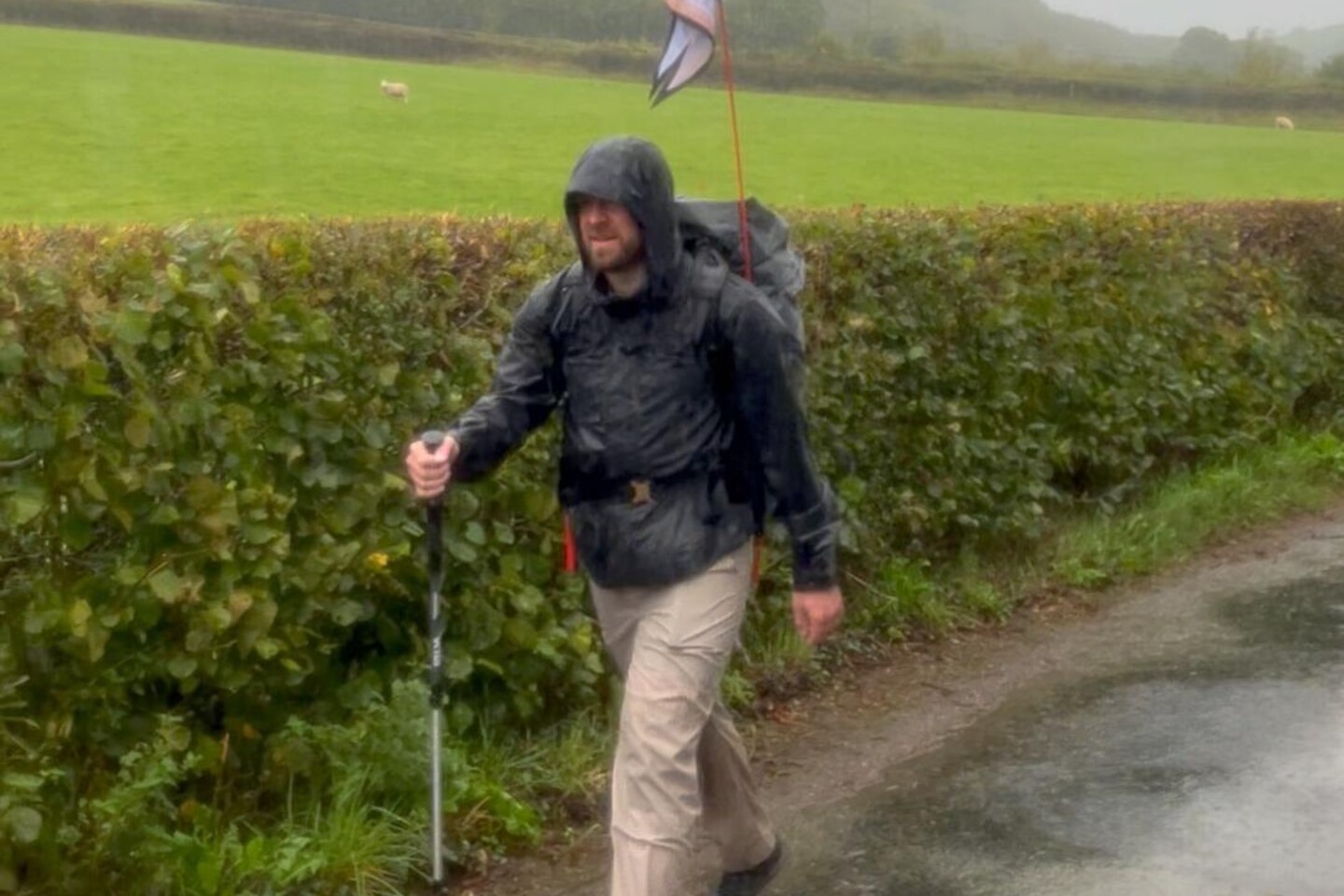
We caught a taxi from our overnight stay in Newtown at 8am on Saturday 20th September, arriving at Hafren Forest car park to sort kit and get ready. By 9:30am we were on our way, following the Severn Way, the famous long distance walking route that traces the river from source to sea. What followed was one of the wettest days of 2025. Not a passing shower. Consistent, heavy, relentless rain with absolutely no let-up. Hafren Forest is a beautiful, often overlooked corner of Mid Wales, but in that weather, with the paths already sodden, it was genuinely tough going. Despite the conditions, it was refreshing to see so many people still out there. Families, avid hikers, even young children making the most of it. We stopped for a snack at one point and ended up having a lovely chat with a couple who were out doing the same. There's something good about seeing people in the hills, away from screens, getting on with it. There were moments where the thought of stopping crossed my mind. Alex didn't let that thought settle. His humour and refusal to make the conditions feel like anything other than a minor inconvenience kept me moving. We were supposed to be camping that night. That wasn't going to happen.
By the time we rolled into Llanidloes it was dark, headtorches on, completely soaked through after 30km on foot. The hiking kit hadn't helped. I'd spent so much on kayaking and cycling gear that the hiking kit had taken a back seat budget-wise. Day one made that very clear. Waterproofing on the boots, jacket and backpack was not up to a day like that. Something to address before the Rhone. The rain didn't just cost us a night under canvas. It set off a chain of events that would reshape the entire expedition.
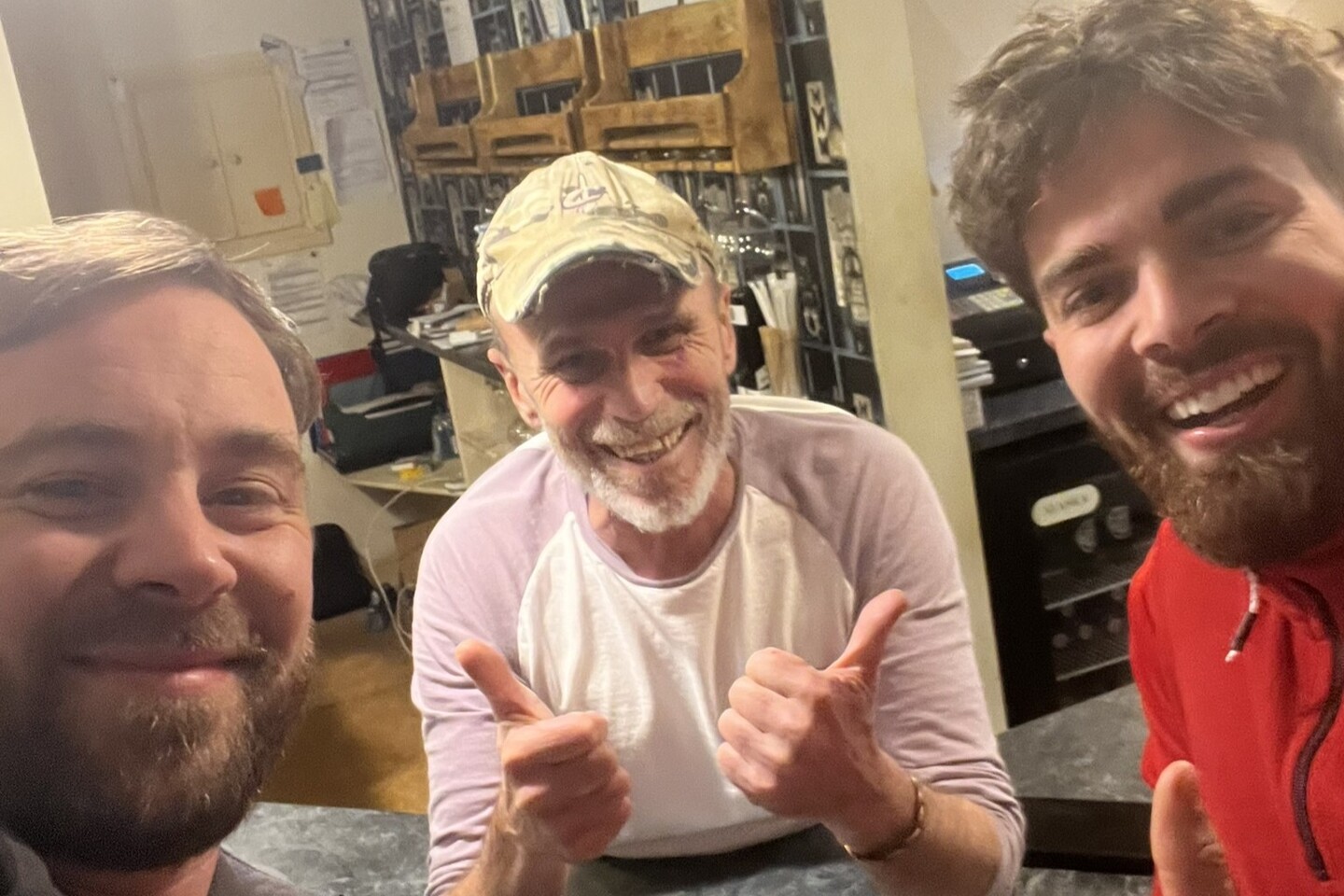
Step forward Michael, the owner of The Unicorn Hotel in Llanidloes. Originally from South Africa, where hospitality is a way of life, Michael took one look at two soaking wet hikers and didn't hesitate. Heavily discounted rooms, an incredible South African BBQ, breakfast in the morning, and a heroic attempt to dry out our soaking kit. It was at this point that Alex made a confession. In a masterclass of ultralight packing, he had decided spare trousers were an unnecessary luxury. One pair. Soaking wet. No backup. Michael disappeared and returned with a pair of his own joggers. The sight of Alex sitting down to a South African BBQ in a South African man's joggers is not something I'll forget in a hurry.
We weren't the only ones sheltering. A couple were eating there that evening and we got chatting. About ten minutes in we all realised we'd crossed paths with them earlier on the hike back down from the source. Small world. If you're ever passing through Llanidloes, stop in for a drink and a meal. Say hi from me.
The sight of Alex sitting down to a South African BBQ in a South African man's joggers is not something I'll forget in a hurry.
Boggy Paths and Glorious Sunshine
Day two brought glorious sunshine, though the first challenge came before even stepping outside. Pulling on cold, soaking wet boots is a particular kind of misery. Despite Michael's best efforts, the boots and hiking gear were still very wet. The feet were holding up, but the quiet prayer was that another day in soggy boots wasn't going to cause real damage before the cycling began.
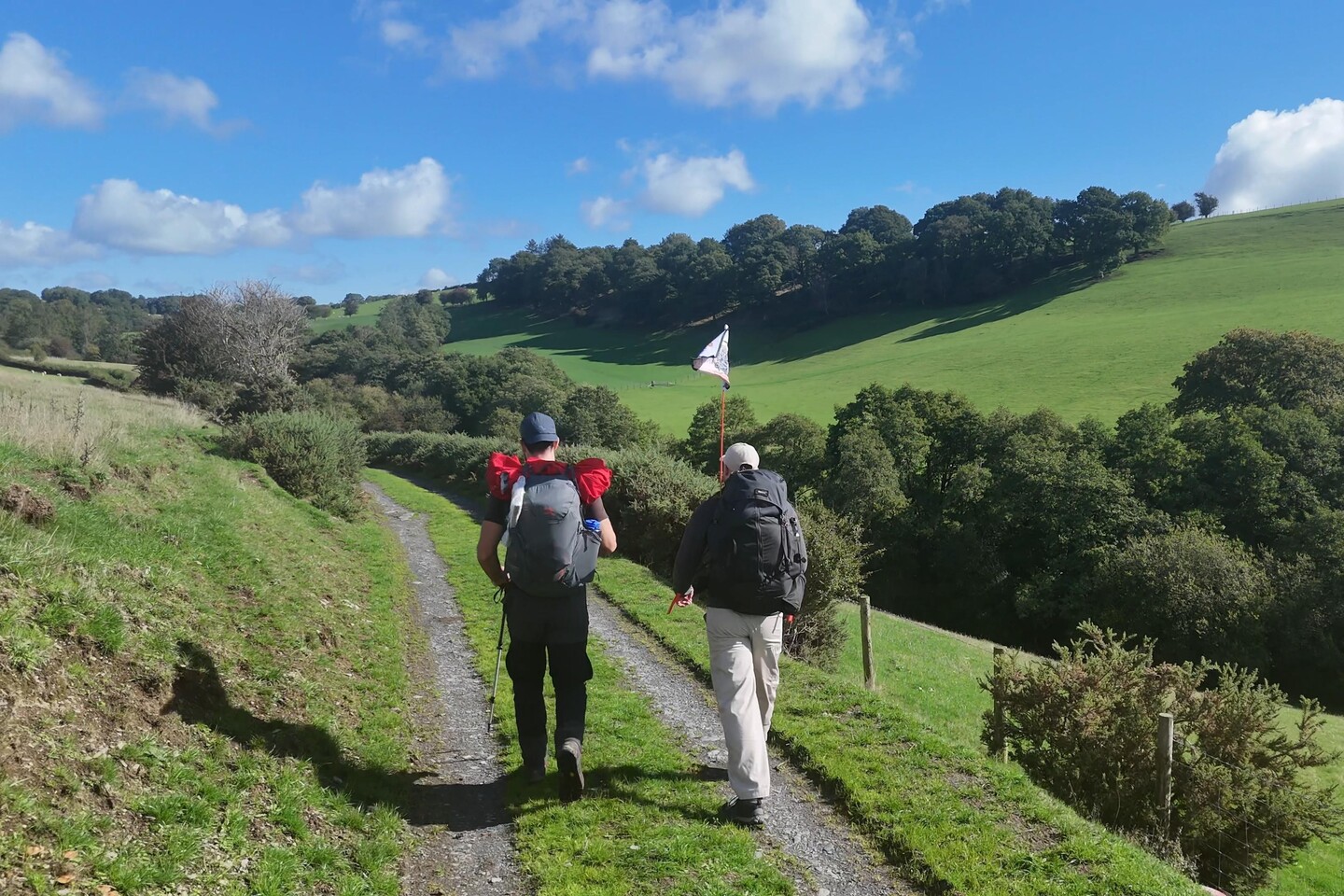
Spirits lifted walking out into the sunshine, until we hit the first flooded path and had to wade straight through it. Spirits dampened, literally. That soon gave way to a moment of irony that made us both laugh. We were tracing a river from source to sea, and the river had come to find us first. The paths between Llanidloes and Newtown were still heavily flooded in places, making progress slow despite the blue skies overhead.
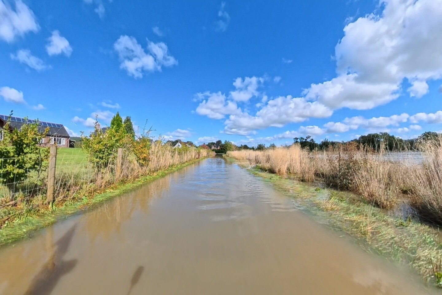
A highlight was a lunch stop at the Season Cafe in Caersws. A full English breakfast, at lunchtime, after a morning of mud and flooded roads. One of the best decisions of the expedition. If you're passing through on the Severn Way, don't walk past it.
Conversation with Alex centred on the flooding and the options ahead. I spent too much time staring at my phone checking river gauges while walking. Alex was less helpful when it came to kayaking advice. Unsurprising, given he has absolutely no kayaking experience. A brilliant hiking companion. Less useful as a white water consultant.
The hike finished just west of Newtown, completing 31km and rounding off 61km across the two days. At the end of it, Alex headed home. One day of biblical rain, one of boggy sunshine, and relentless kilometres throughout, and he'd been brilliant for every one of them. Saying goodbye was harder than I expected. For the most part, the next six days would be mine alone to navigate. The river felt a little bigger after he left.
The Plan Falls Apart
The flooding caused by that first day's rain was severe. The river gauge at Crew Green, near to where I had planned to put my kayak in the water on the afternoon of Day 3, read 1.1 metres on Saturday morning. By Sunday afternoon it had hit 6.6 metres, close to its highest ever recorded level. I wouldn't get on the river above 3.5 to 4 metres. At 6.6, the put-in point wasn't just inadvisable. It was completely inaccessible and dangerous.
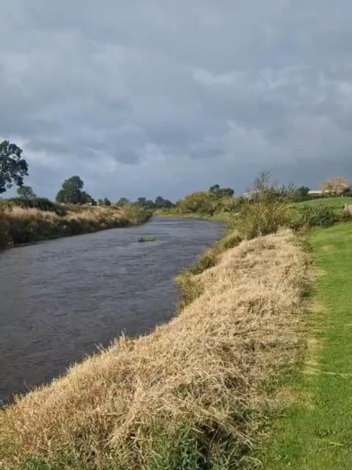
One of the more complex dynamics of a flooded river is that peak water levels travel downstream with a delay. Even if levels looked lower further down the river, the peak might not have arrived yet. Understanding how the Severn behaves after a flood helped enormously, but it also made planning considerably more complicated. You couldn't just look at one gauge and make a decision.
By the afternoon of Day 2 one thing was clear: Day 3 would be on the bike. Beyond that, nothing was certain. Each day would be a judgement call, monitoring water levels while still making forward progress. Logistics, accommodation, routes: all of it rethought on the fly, one day at a time.
Throughout this chaos, my wife was quietly doing something remarkable. She drove around Shropshire with a kayak loaded on the car, scouting the river each day, checking whether levels had dropped enough. All while looking after our two daughters, doing the school run, and keeping normal family life ticking over. With everything MS already asks of her, she was out there doing that. I won't forget it.
Newtown to Shrewsbury and a Call from the BBC
The transition from boots to bike after two days of hiking was a welcome one. Jonathan, an early Source2Sea follower on Instagram, had reached out not long after I published the route to offer to ride alongside for a section. We'd even met up before the expedition to scout part of the cycling route together, so having him there felt like a familiar face at exactly the right moment.
The route from Newtown followed the Montgomery Canal towpath towards Welshpool. A beautiful stretch, though with a hazard I hadn't fully accounted for. The canal is crossed by a series of very low bridges, low enough to duck under on a bike. Fine in theory. Less fine when you're carrying a large flag pole on the back and moving at pace. I forgot that more than once. There were near misses that would have made for an embarrassing end to the expedition before it had really begun.
I was also carrying all my hiking gear on the bike. My wife and the kayak kit were waiting at Jonathan's house further along the route. We rode together as far as The Royal Hill pub at Pentre, where my wife was waiting. We sorted through the kit, reorganising for what was now looking like a few days on the bike. She took the kayak gear and the rather ripe hiking kit back home in the car. Another quiet act of support that made more difference than it sounds.
From Pentre to Shrewsbury was unplanned territory and the first moment the Beeline Velo 2 truly came into its own. I found somewhere to stay in Shrewsbury, plugged it into the app, selected the quiet route option, and off I went. No stress, no scrambling over maps, no second guessing. Just follow the device. Days three, four and five showed exactly why it deserves the praise.

Arriving into Shrewsbury I got a call from BBC Radio Shropshire, who invited me in the following morning for a live chat on air. At 66km, day three was the longest of the three unplanned cycling days. Pre-booked accommodation didn't always line up with where an unplanned day naturally ended. Another lesson learnt. That evening the river levels were still too high. Day four would be another day on the bike.
Shrewsbury to Ironbridge, Denise, the BBC and a Bench by the River
The day started with the BBC Radio Shropshire interview. Talking about Source2Sea, the MS Society, and the river ahead on local radio was a brilliant way to start the day. I later found out it had come via a tip-off from my friends at BBC Hereford and Worcester, my local home station, where I've appeared live in the studio a few times and who have been incredibly supportive of Source2Sea from early on. A good word in the right ear goes a long way.

Post interview and before setting off on the day's ride, I grabbed a coffee and found a bench in the park next to the river to plan the route. A few minutes in, an older lady appeared walking her two dogs. We chatted for about twenty minutes. She told me a dear friend of hers, no longer with her, had lived with MS and said what I was doing was incredible, albeit completely mad.
As she said goodbye, she pressed a £20 note into my hand. "In memory of my friend Denise," she said, and walked on.
I never caught her name. She probably has no idea how much that moment spurred me on. She wasn't the only person along the route who stopped and donated, not by a long way. But she's the one that will stick in my memory long after the others have faded.
I thought about Denise for a lot of the journey that followed. Someone I never met, but whose memory had just been pressed into my hand by a stranger on a bench. About her, and about how many others there must be out there. People with close connections to MS, families affected by it, friends who have lost someone to it. Every one of them a reason to keep going.
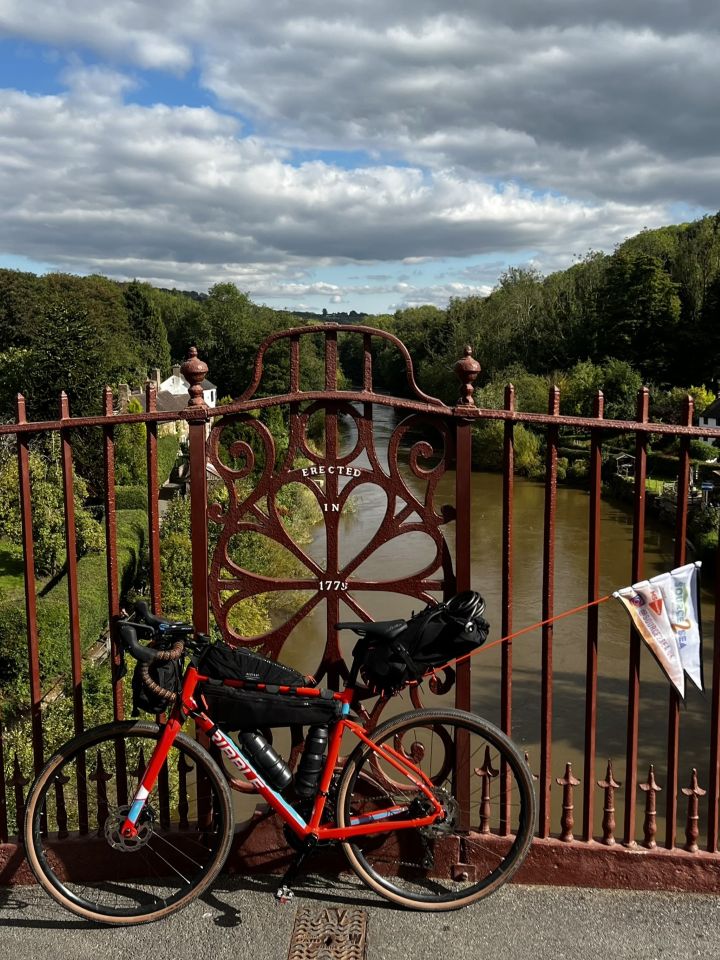
The route followed National Cycle Route 81 out of Shrewsbury before crossing onto National Cycle Route 45 all the way to Ironbridge, passing close to the ancient Roman settlement of Wroxeter. I had a very specific motivation to make progress: Eley's Pork Pies. World famous, made in Ironbridge, and only available until the day's stock has run out. The gorge, the world's first iron arch bridge, the sense that something enormous happened here. Worth pausing for. I did pause. Briefly. There was a pork pie to collect.

The campsite for the night was at the top of the tallest hill in the area, while Eley's sat at the bottom of the gorge. Worth every metre of the climb. At 40km, it was a shorter day, with time spent scouting river put-in points and working through logistics. The levels were heading in the right direction at last. One more day on the bike.
She wasn't the only person along the route who stopped and donated, not by a long way.
Ironbridge to Bewdley, into Worcestershire
The route from Ironbridge followed National Cycle Route 45 more or less the entire way to Bewdley, again plotted automatically on the Beeline Velo 2. Three days in and the device had become an indispensable part of the daily routine. Enter the destination, trust the route, focus on moving.

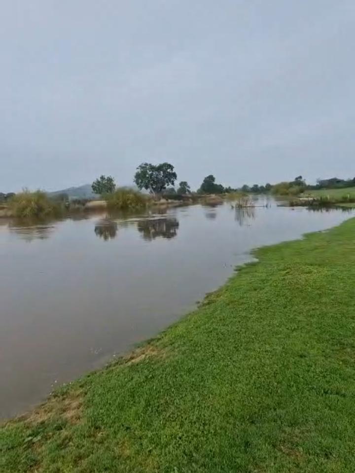
There was one deliberate diversion. Bridgnorth sits on this stretch of the Severn and I know it well. Severn Park has a concrete ramp down to the river, one I've used plenty of times during training, and it felt like the obvious place to check whether the levels had finally dropped enough. My wife was there waiting with the kayak. Hope was high.
It wasn't to be. The water had dropped visibly since the peak, but the ramp is steep and the levels were still too unpredictable to safely launch on my own. My wife was unable to physically help with the kayak on that kind of gradient. Standing there, looking at the river, so close and yet still not quite there, was a frustrating moment. Plan adjusted. Continue to Bewdley.
At 49km, constrained again by pre-booked accommodation, Bewdley was the destination. By the end of the day the news I'd been waiting for finally came. The levels had dropped enough. Tomorrow, the kayak goes in the water.
That evening I put a last minute message to Bewdley Rowing Club on Facebook, explaining what I was doing and asking to use their facilities to launch from first thing in the morning. What felt like an eternity was probably thirty minutes before a reply came. They'd be there to meet me, unlock up and help me launch. One less thing to worry about.
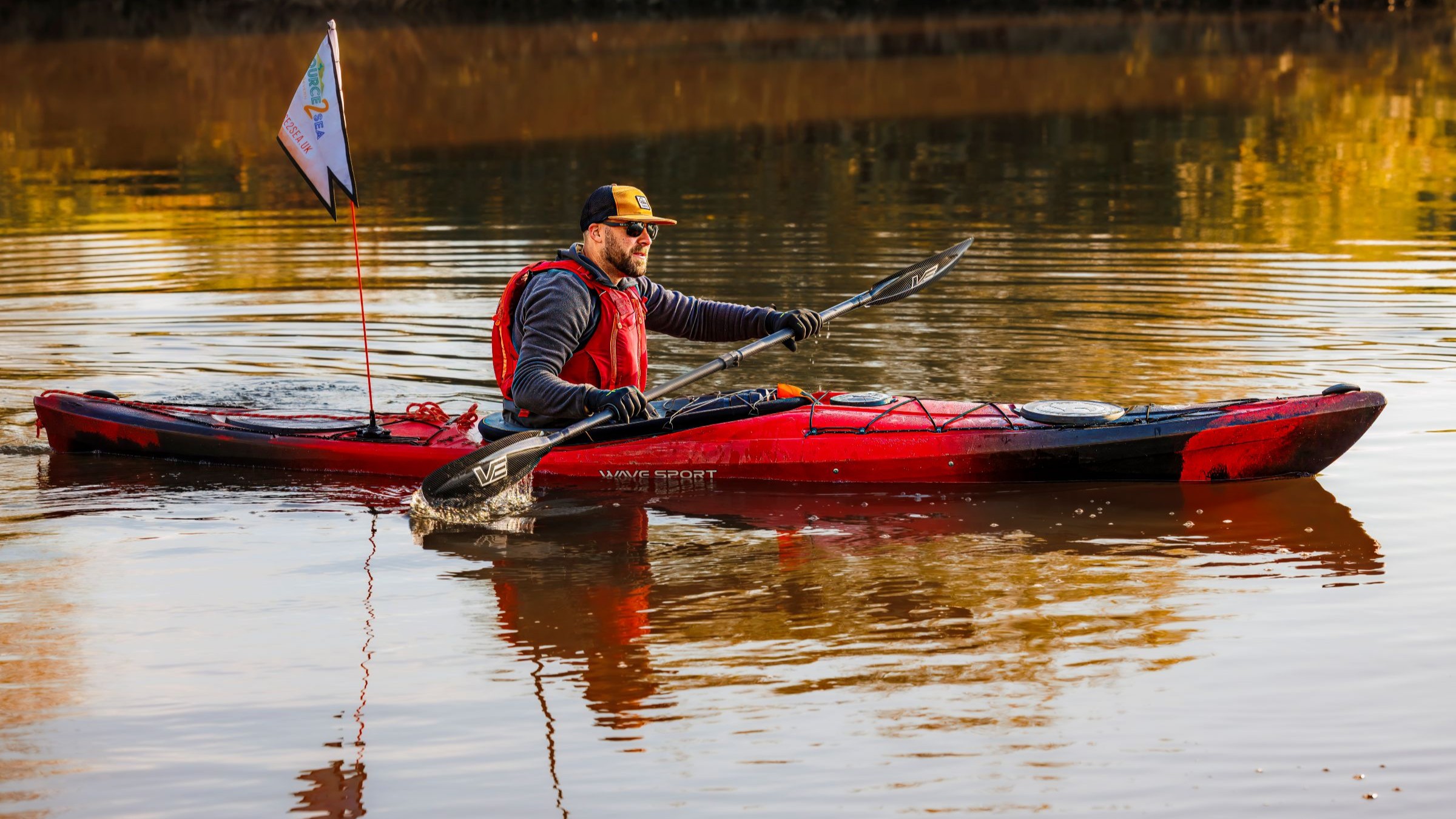
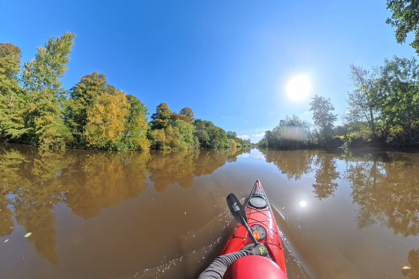
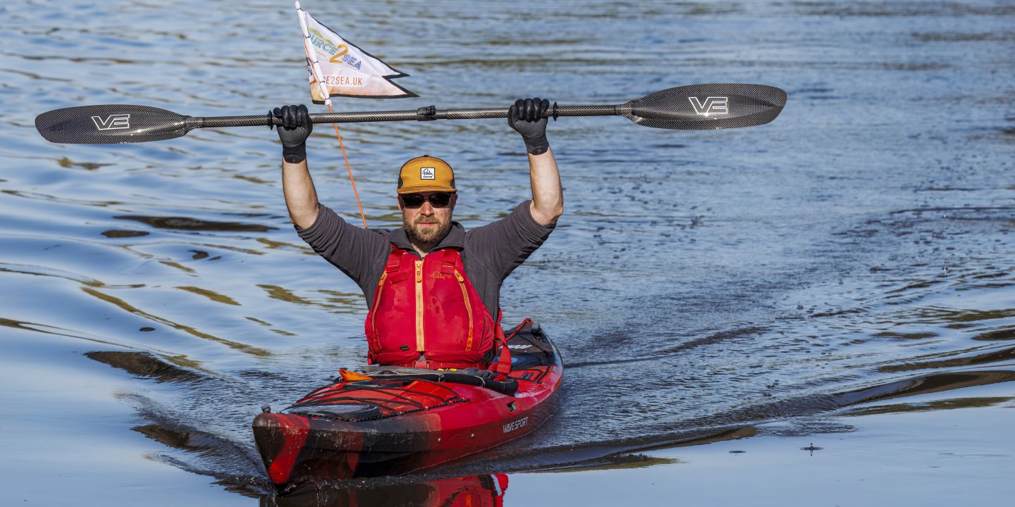
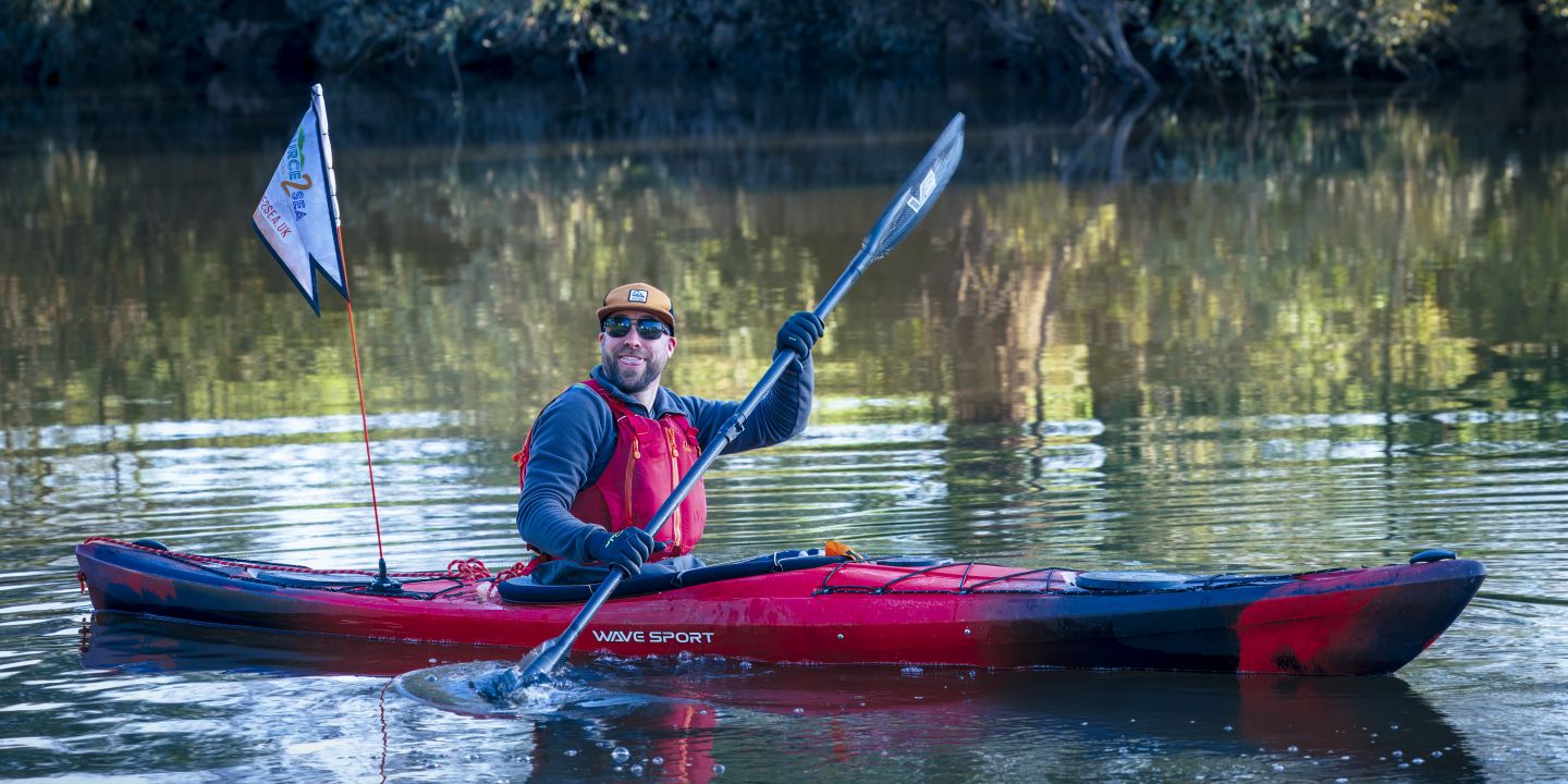
On the Water at Last, Bewdley to Clevelode
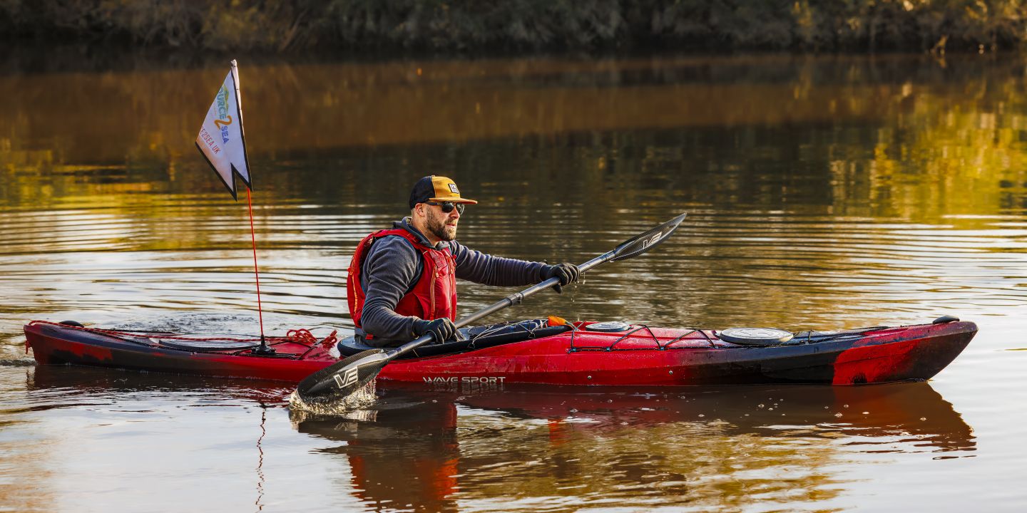
True to their word, Chris and the team at Bewdley Rowing Club were there first thing. They unlocked the facilities, helped get the kayak set up and on the water, and sent me off with a smile. It was exactly the kind of welcome you hope for but don't always get. The Wave Sport Hydra 125 made every kilometre feel manageable. Its glide through the water is effortless, the storage capacity handled everything I needed to carry, and the fit and comfort meant I wasn't fighting the boat. I was just paddling. For an expedition of this nature, that matters enormously.
Paddling through Worcester City Centre is something I do regularly in training, but it never loses its magic. Gliding past Worcester Cathedral standing high on the bank to my left, it felt surreal in the best possible way. A familiar stretch of water that somehow feels different every single time.
The locks on the Severn are manned, and every keeper I came across was friendly and helpful. Four locks on day six. Three straightforward. The fourth was a different story. A few weeks before the expedition I'd found out that Bevere Lock, just north of Worcester, was going to be completely closed for essential repairs by the Canal and Rivers Trust. Of all the locks on the Severn, Bevere is one of the trickiest portages at the best of times. With water levels still higher than normal, it was even more of a challenge. Getting out wasn't too bad. Finding somewhere safe to get back in was another matter. The kayak had to be lugged through kissing gates and around 0.5km down the riverbank before a safe re-entry point could be found. Not the most elegant moment of the expedition, but we got there.
At Worcester Rowing Club, my wife and both daughters were waiting. The first time I'd seen the girls since leaving for Hafren Forest. That pitstop wasn't on any route plan, but it's one of the most vivid memories of the whole expedition. The day finished at Riverside Caravan Park in Clevelode, near Clevelode, after 35km on the water. A further 11km south from the family pitstop in Worcester.
The Long Push to Gloucester

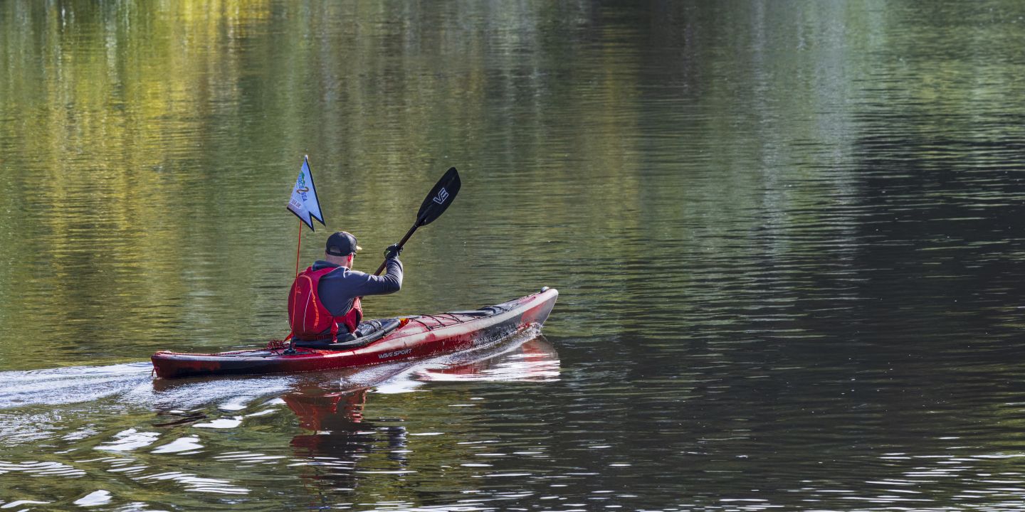
After five days of hiking and cycling, the idea had been that a day on the kayak would give the legs a rest. They weren't doing much on the water, but six consecutive days of effort has a way of making itself known regardless.
There was also a quieter feeling leaving Clevelode. This was always meant to be the final day of four and a half on the water. Instead it was day two of two. Kayaking is without doubt my favourite of the three disciplines, and knowing this was my last day on the river stung a little. But the mission was the mission. You adapt and you keep moving.
Passing through Upton upon Severn, I was met on the riverbank by Rob from Cotswold Photos, a good friend and incredible photographer. Most of the images on the Source2Sea website from this expedition are his. A friendly face at exactly the right moment.
Further south the river changes character, broader and slower as the tidal section approaches. By Gloucester the fatigue was real. Ian, chairman of Gloucester Kayak and Canoe Club, and his wife Yvonne were waiting at Gloucester Docks. The docks locks were closed to paddle craft, ironically due to low water levels on the canal side. The only exit was a set of steps caked in mud from the high river levels earlier in the week. Ian and Yvonne had done their best to clear them. After 41km it was not a graceful exit. But it was a dry one. They then gave me, my kayak, and all my kit a lift to my dad's house for the night. Another act of generosity from people I'd only just met.
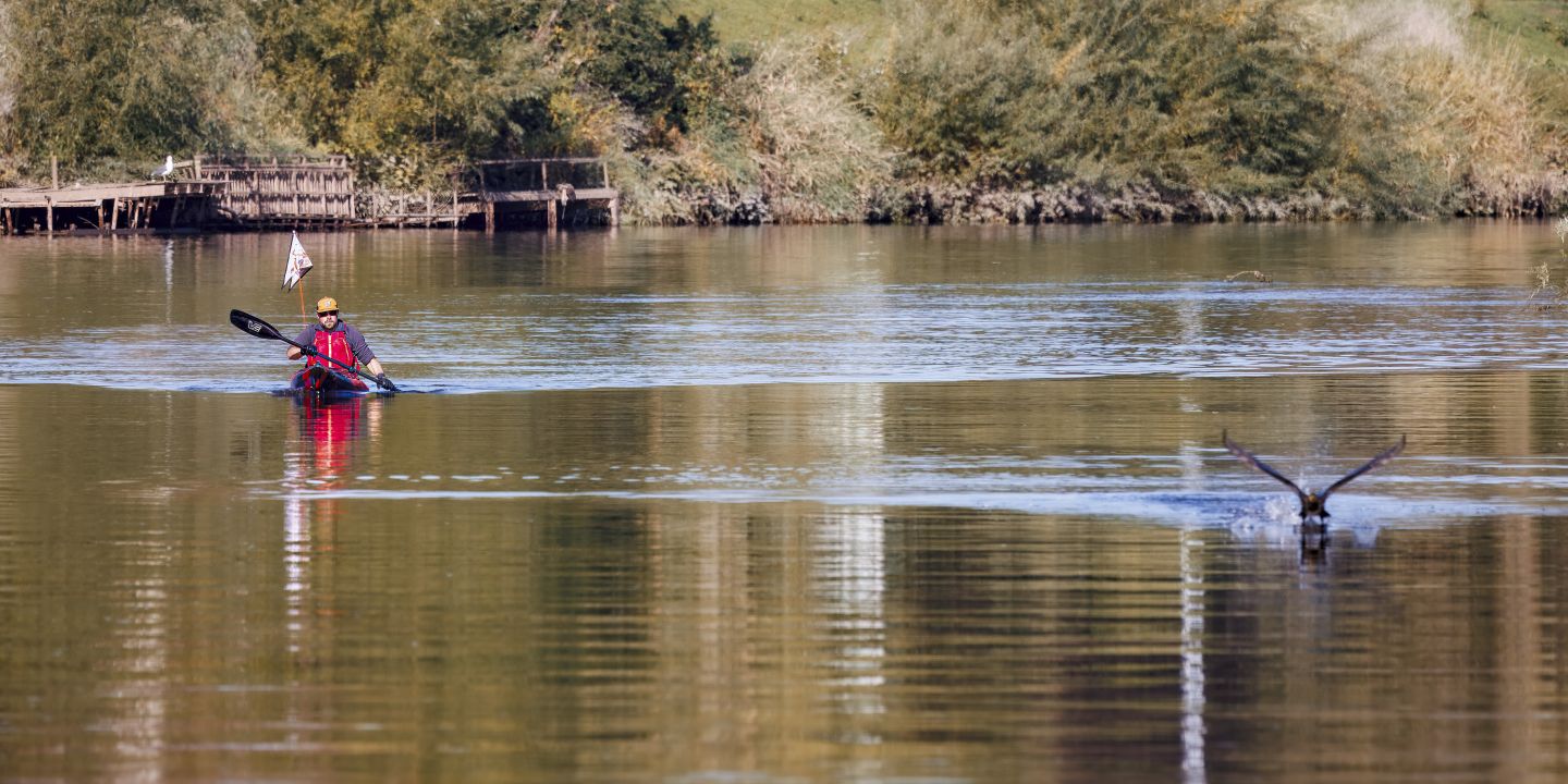
Day 7 on the River Severn — photography by Rob, Cotswold Photos
Gloucester to the Finish Line, All Roads Lead to Portishead
Waking up at my dad's was exactly what was needed. A familiar place, no need to think about anything other than getting on the bike and finishing what had been started eight days earlier.
My dad, Graham, has been cycling for decades, from mountain biking to road and gravel. Now in his 60s he could still comfortably outpace me. We've ridden together before, but this was something different. Having him alongside for the entire 81km meant everything.
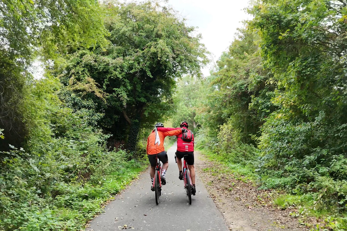
The route followed National Cycle Route 41 south from Gloucester towards Avonmouth. This stretch of the Severn is where I grew up. Towns and villages I've known my whole life, roads I've cycled as a kid, landscapes woven into my earliest memories. Riding through them on the final day of the first Source2Sea expedition, with my dad beside me, was one of those moments that's hard to put into words.
There's debate about exactly where the River Severn ends and the Bristol Channel begins. The most commonly cited answer is the Severn Bridges. To be safe, I went a little further, to Battery Point at Portishead. If I was going to do this, I was going to do it properly.
The Severn Bridges had been visible for a while, but passing through Severn Beach you find yourself right at the base of them. That was the moment it started to feel real. Just beyond them, the distinctive landmass of Battery Point jutting out into the estuary. The end was in sight. Literally.
With Battery Point locked in the sights, it was time to make the final push. Crossing Avonmouth Bridge was an experience in itself, a vast industrial crossing with the estuary stretching out below. From there, National Cycle Route 26 carried us up into Portishead.
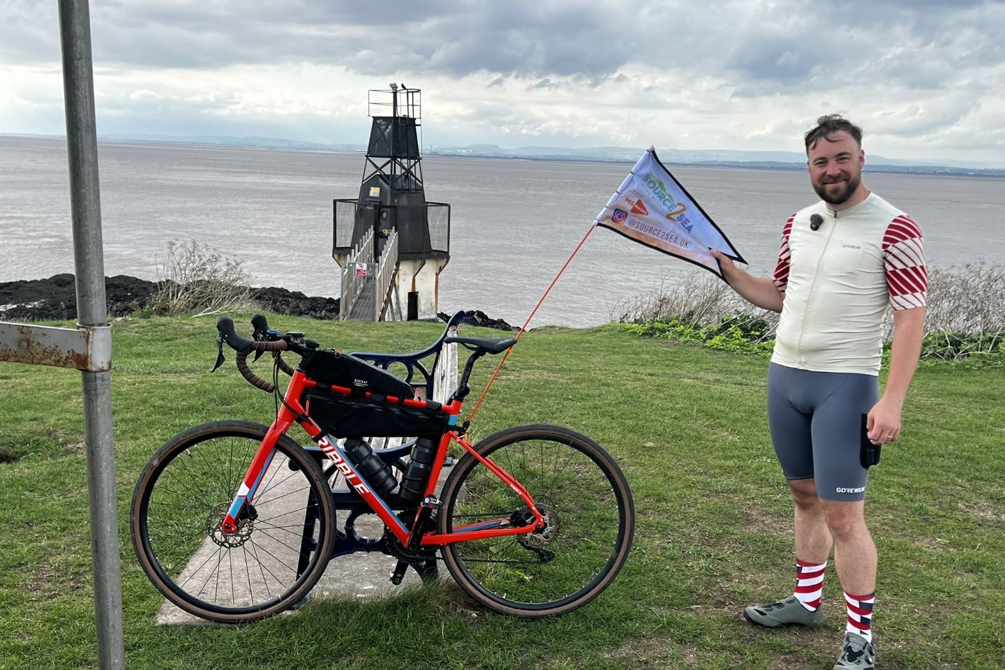
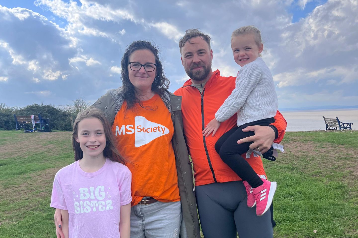
My wife, both daughters, and a small group of family and friends were waiting at the finish line. After 373km, eight consecutive days, three disciplines, one flooded river and a completely rewritten plan, the first of five expeditions was done. An embrace with Nikki and the girls said everything that words couldn't. Emotional and exhausted in equal measure.
Shortly after, a donation appeared on the fundraising page. £342. Exactly the distance I had just covered, in pounds. Anonymous. Whoever you are, thank you. I still think about it. I don't think I ever will forget it.
342. Exactly the distance I had just covered, in pounds.
One Down. Four to Go.
The River Severn tested everything. The weather, the plan, the kit, the body, and more than once, the mind. It didn't go the way I'd drawn it up, but then the best stories rarely do. What it gave me instead was proof that this mission is possible, that people care, and that the support from strangers, friends, family and the MS community is real and extraordinary.
Eight days. 373km. One flooded river, three unplanned cycling days, a South African BBQ, a pork pie on a hill, a bench in Shrewsbury, a lady and her dogs, and a £342 donation from someone I'll never know. The Severn was the first chapter. There are four more to come.
The GiveStar donation page for Source2Sea covers all five expeditions and remains open throughout the mission. Including Gift Aid, the current total stands at £4,136. Every pound goes directly to the MS Society. If you'd like to contribute, use the button below.
Expedition Two launches on 14th September 2026. The River Rhone, 880km from the Swiss Alps to the Mediterranean. A bigger river, bigger terrain, and a bigger challenge. The plan is already in motion.
Planned route: River Rhone, 880km from the Swiss Alps to the Mediterranean — Expedition Two, September 2026.
For Nikki. For everyone living with MS. For Denise.
Five rivers. Five years. One mission.
Adventure with Purpose.